
伯方島 topographic map
Interactive map
Click on the map to display elevation.
About this map
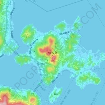
Name: 伯方島 topographic map, elevation, terrain.
Location: 伯方島, 今治市, 愛媛県, 794-2301, 日本 (34.19093 133.05401 34.24199 133.14051)
Average elevation: 28 m
Minimum elevation: -1 m
Maximum elevation: 302 m
Other topographic maps
Click on a map to view its topography, its elevation and its terrain.