
鵜島 topographic map
Interactive map
Click on the map to display elevation.
About this map
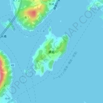
Name: 鵜島 topographic map, elevation, terrain.
Location: 鵜島, 今治市, 愛媛県, 日本 (34.18146 133.08247 34.19487 133.09437)
Average elevation: 10 m
Minimum elevation: 0 m
Maximum elevation: 138 m
南北約1.5キロ、東西約0.8キロ、面積0.76km2の小島で、周囲は集落のある地域を除いて崖となっている。島の中心は標高84mの小高い山となっている。付近は潮の流れも速い。
Other topographic maps
Click on a map to view its topography, its elevation and its terrain.