
上北手百崎字内山 topographic map
Interactive map
Click on the map to display elevation.
About this map
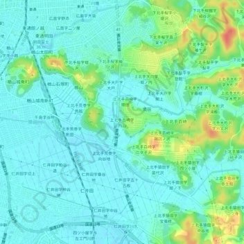
Name: 上北手百崎字内山 topographic map, elevation, terrain.
Location: 上北手百崎字内山, 秋田市, 秋田県, 010-8560, 日本 (39.67346 140.13000 39.71346 140.17000)
Average elevation: 16 m
Minimum elevation: 3 m
Maximum elevation: 56 m
Other topographic maps
Click on a map to view its topography, its elevation and its terrain.