
上新城道川字雷 topographic map
Interactive map
Click on the map to display elevation.
About this map
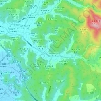
Name: 上新城道川字雷 topographic map, elevation, terrain.
Location: 上新城道川字雷, 秋田市, 秋田県, 010-0135, 日本 (39.76281 140.11453 39.80281 140.15453)
Average elevation: 62 m
Minimum elevation: 4 m
Maximum elevation: 227 m
Other topographic maps
Click on a map to view its topography, its elevation and its terrain.