
広面字樋ノ沖 topographic map
Interactive map
Click on the map to display elevation.
About this map
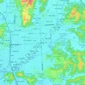
Name: 広面字樋ノ沖 topographic map, elevation, terrain.
Location: 広面字樋ノ沖, 秋田市, 秋田県, 010-0041, 日本 (39.69804 140.12944 39.73804 140.16944)
Average elevation: 18 m
Minimum elevation: 4 m
Maximum elevation: 75 m
Other topographic maps
Click on a map to view its topography, its elevation and its terrain.