
楢山字寺小路 topographic map
Interactive map
Click on the map to display elevation.
About this map
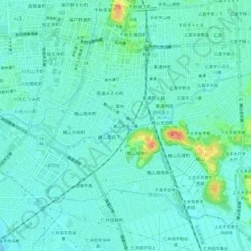
Name: 楢山字寺小路 topographic map, elevation, terrain.
Location: 楢山字寺小路, 秋田市, 秋田県, 010-0013, 日本 (39.68449 140.10530 39.72449 140.14530)
Average elevation: 10 m
Minimum elevation: -1 m
Maximum elevation: 46 m
Other topographic maps
Click on a map to view its topography, its elevation and its terrain.