
蕎麦粒山 topographic map
Interactive map
Click on the map to display elevation.
About this map
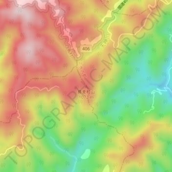
Name: 蕎麦粒山 topographic map, elevation, terrain.
Location: 蕎麦粒山, 大町市, 上水内郡, 長野県, 日本 (36.64589 137.91120 36.64599 137.91130)
Average elevation: 933 m
Minimum elevation: 713 m
Maximum elevation: 1,119 m
Other topographic maps
Click on a map to view its topography, its elevation and its terrain.