
不動岳 topographic map
Interactive map
Click on the map to display elevation.
About this map
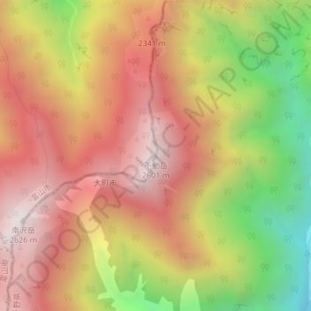
Name: 不動岳 topographic map, elevation, terrain.
Location: 不動岳, 大町市, 長野県, 日本 (36.49541 137.66743 36.49551 137.66753)
Average elevation: 2,083 m
Minimum elevation: 1,339 m
Maximum elevation: 2,619 m
Other topographic maps
Click on a map to view its topography, its elevation and its terrain.