
鹿島槍ヶ岳 topographic map
Interactive map
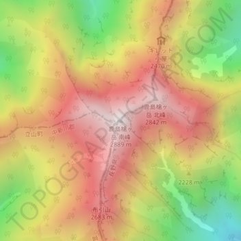
Click on the map to display elevation.
About this map
Name: 鹿島槍ヶ岳 topographic map, elevation, terrain.
Location: 鹿島槍ヶ岳, 大町市, 長野県, 日本 (36.62452 137.74700 36.62462 137.74710)
Average elevation: 2,308 m
Minimum elevation: 1,593 m
Maximum elevation: 2,871 m
鹿島槍ヶ岳(かしまやりがたけ)は、富山県黒部市、中新川郡立山町および長野県大町市にまたがる後立山連峰(飛騨山脈)の標高2,889 mの山。中部山岳国立公園内にある。後立山連峰の盟主とされる。
Other topographic maps
Click on a map to view its topography, its elevation and its terrain.