
菅野湖 topographic map
Interactive map
Click on the map to display elevation.
About this map
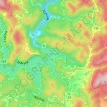
Name: 菅野湖 topographic map, elevation, terrain.
Location: 菅野湖, 周南市, 山口県, 日本 (34.11841 131.86199 34.15745 131.92315)
Average elevation: 355 m
Minimum elevation: 187 m
Maximum elevation: 582 m
Other topographic maps
Click on a map to view its topography, its elevation and its terrain.