
大潮 topographic map
Interactive map
Click on the map to display elevation.
About this map
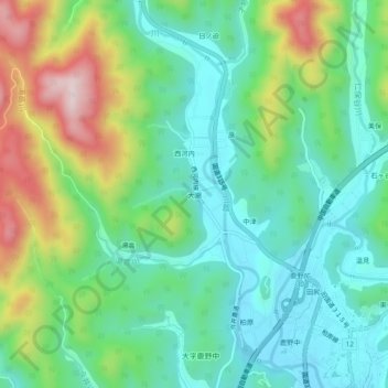
Name: 大潮 topographic map, elevation, terrain.
Location: 大潮, 周南市, 山口県, 日本 (34.22503 131.77753 34.26503 131.81753)
Average elevation: 485 m
Minimum elevation: 349 m
Maximum elevation: 791 m
Other topographic maps
Click on a map to view its topography, its elevation and its terrain.