
西 topographic map
Interactive map
Click on the map to display elevation.
About this map
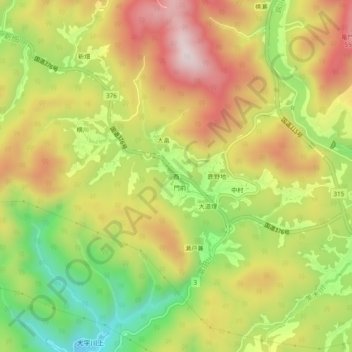
Name: 西 topographic map, elevation, terrain.
Location: 西, 周南市, 山口県, 日本 (34.12077 131.78667 34.16077 131.82667)
Average elevation: 371 m
Minimum elevation: 98 m
Maximum elevation: 632 m