
東久留米市 topographic map
Interactive map
Click on the map to display elevation.
About this map
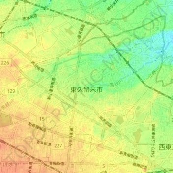
Name: 東久留米市 topographic map, elevation, terrain.
Location: 東久留米市, 東京都, 日本 (35.73206 139.48452 35.77423 139.54783)
Average elevation: 62 m
Minimum elevation: 38 m
Maximum elevation: 80 m
Other topographic maps
Click on a map to view its topography, its elevation and its terrain.