
Make a donation
Mori topographic map
Click on the map to display elevation.
Make a donation
About this map
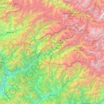
Name: Mori topographic map, elevation, terrain.
Location: Mori, Uttarkashi, Uttarakhand, 249128, India (30.91865 77.80955 31.28508 78.62902)
Average elevation: 3,191 m
Minimum elevation: 867 m
Maximum elevation: 6,498 m
Make a donation
Other topographic maps
Click on a map to view its topography, its elevation and its terrain.
Lansdowne
India > Uttarakhand > Lansdowne
Lansdowne is a quaint hill station in the Pauri Garhwal district of Uttarakhand, India. Lodged in the picturesque surroundings of the Himalayan ranges, it lies at an elevation of approximately 1,700 meters (5,577 feet) above sea level. The town is about 45 kilometers (28 miles) from the district headquarters,…
Average elevation: 1,140 m
Make a donation
Dehradun
India > Uttarakhand > Dehradun
The city of Dehradun mainly lies in Doon Valley and is at a varying height from 410 m (1,350 ft) in Clement Town to above 700 m (2,300 ft) at Malsi which is 15 km (9.3 mi) from the city. However, the average elevation is 450 m (1,480 ft) above sea level. Malsi is the starting point of Lesser Himalayan Range…
Average elevation: 904 m
Pantnagar
India > Uttarakhand > Kichha
The Campus appears impressive today with its well-tended fields, a network of roads, housing colonies, street lighting, a telephone exchange, hospitals, marketing centres, a water supply section, a community radio station 90.8 MHz, canteens, 6 primary schools and 3 secondary schools. The main campus lies in…
Average elevation: 233 m
Make a donation
Roorkee
India > Uttarakhand > Roorkee
Roorkee is located at 29°52′N 77°53′E / 29.87°N 77.88°E / 29.87; 77.88. It has an average elevation of 268 metres (879 ft).
Average elevation: 270 m
Make a donation
Make a donation
Rishikesh
India > Uttarakhand > Rishikesh
Rishikesh is at 30°06′12″N 78°17′41″E / 30.103368°N 78.294754°E / 30.103368; 78.294754. It has an average elevation of 372 metres (1,220 ft). The town is located in the Tehri Garhwal region of the northern Indian state of Uttarakhand.
Average elevation: 497 m
Milam Glacier
India > Uttarakhand > Munsiari tehsil
Milam Glacier, covering around 37 km2 (14 sq mi) area of 16 km (10 mi) length, is located about 15 kilometres (9 mi) northeast of Nanda Devi. It ranges in elevation from about 5,500 metres (18,000 ft) to about 3,870 metres (12,700 ft) at its snout. Situated on the south facing slope of the main Great Himalayas…
Average elevation: 5,229 m
Make a donation
Make a donation
Nainital
India > Uttarakhand > Nainital
The city of Nainital covers a total area of 11.73 km2 (4.53 sq mi), and is located at 29°23′N 79°27′E / 29.38°N 79.45°E / 29.38; 79.45, at an average elevation of 2,084 metres (6,837 ft) above sea level. The slopes of the nearby mountains are most populated, with an elevation ranging from…
Average elevation: 1,813 m
Make a donation
Make a donation
Mussoorie
India > Uttarakhand > Dehradun
Mussoorie is at an average altitude of 2,005 metres (6,578 ft). To the northeast are the Himalayan snow ranges, and to the south, the Doon Valley and Shiwalik ranges. The second highest point is the original Lal Tibba in Landour, with a height of over 2,275 m (7,464 ft). Mussoorie is popularly known as The…
Average elevation: 1,594 m
Almora
India > Uttarakhand > Almora
Almora is located at 29°35′50″N 79°39′33″E / 29.5971°N 79.6591°E / 29.5971; 79.6591 in Almora district in Uttarakhand. Almora is situated 365 km north-east the national capital New Delhi and 415 km south-east the state capital Dehradun. It lies in the revenue Division Kumaon and is located…
Average elevation: 1,557 m
Make a donation
Roopkund Lake
India > Uttarakhand > Chamoli Tehsil
Roopkund (locally known as Mystery Lake or Skeleton Lake) is a high altitude glacial lake in the Uttarakhand state of India. It lies in the lap of Trishul massif. Located in the Himalayas, the area around the lake is uninhabited and is roughly at an altitude of 5,020 metres (16,470 ft), surrounded by…
Average elevation: 4,631 m
Make a donation
Make a donation
Make a donation
Make a donation
Make a donation
Make a donation
Gauchar
India > Uttarakhand > Karnaprayag
Gauchar (Garhwali: Gòchàr ) is a Hill Town sort of a valley town located in Karnaprayag tehsil within Chamoli district of Uttarakhand state in India. Gauchar is situated on the left bank of river Alaknanda and is en route to the celebrated holy destination of Badrinath. It is well known for being one of the…
Average elevation: 1,196 m
Make a donation
Gopeshwar
India > Uttarakhand > Chamoli Tehsil
Gopeshwar is located at 30°25′N 79°20′E / 30.42°N 79.33°E / 30.42; 79.33. It has an average elevation of 1,450 m (4,760 ft). Gopeshwar is 8.4 km (5.2 mi) away from Chamoli which is located on the banks of Alaknanda river and along NH 58. Gopeshwar is able to captivate any visitor with its…
Average elevation: 1,566 m
Make a donation
Make a donation
Make a donation
Make a donation
Make a donation
Make a donation
Kotdwar
India > Uttarakhand > Kotdwara
Kotdwar lies on the western margin of the Himalayas, at an altitude of 454 m (1,490 ft) above sea level.
Average elevation: 471 m
Make a donation
Make a donation
Uttarkashi
India > Uttarakhand > Bhatwari
It is the district headquarters of Uttarkashi district. Uttarkashi is situated on the banks of river Bhagirathi at an altitude of 1158 m above sea level. Uttarkashi is generally known as a holy town close to Rishikesh. It is located in the state of Uttarakhand in India. Uttarkashi is home to a number of…
Average elevation: 1,619 m
Make a donation