
Moldoveanu topographic map
Interactive map
Click on the map to display elevation.
About this map
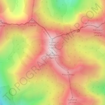
Name: Moldoveanu topographic map, elevation, terrain.
Location: Moldoveanu, Argeș, Romania (45.59951 24.73611 45.59961 24.73621)
Average elevation: 2,142 m
Minimum elevation: 1,570 m
Maximum elevation: 2,520 m
Other topographic maps
Click on a map to view its topography, its elevation and its terrain.
Bejan-Târnăvița
Romania > Hunedoara > Căinelu de Jos
Bejan-Târnăvița, Căinelu de Jos, Șoimuș, Hunedoara, 337453, Romania
Average elevation: 277 m