
Thank you for supporting this site ❤️
Make a donation
Make a donation
Boița topographic map
Click on the map to display elevation.
Thank you for supporting this site ❤️
Make a donation
Make a donation
About this map
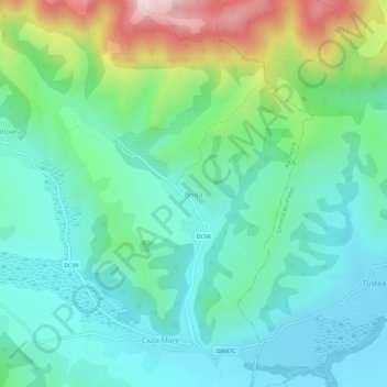
Name: Boița topographic map, elevation, terrain.
Location: Boița, Răchitova, Hunedoara, 337371, Romania (45.58954 22.80028 45.62954 22.84028)
Average elevation: 501 m
Minimum elevation: 362 m
Maximum elevation: 900 m
Thank you for supporting this site ❤️
Make a donation
Make a donation
Other topographic maps
Click on a map to view its topography, its elevation and its terrain.
Thank you for supporting this site ❤️
Make a donation
Make a donation