
高妻山 topographic map
Interactive map
Click on the map to display elevation.
About this map
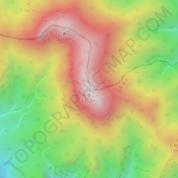
Name: 高妻山 topographic map, elevation, terrain.
Location: 高妻山, 長野市, 長野県, 日本 (36.80003 138.05189 36.80013 138.05199)
Average elevation: 1,854 m
Minimum elevation: 1,336 m
Maximum elevation: 2,325 m
Other topographic maps
Click on a map to view its topography, its elevation and its terrain.