
戸隠山 topographic map
Interactive map
Click on the map to display elevation.
About this map
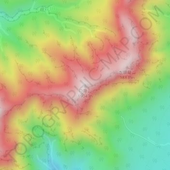
Name: 戸隠山 topographic map, elevation, terrain.
Location: 戸隠山, 長野市, 長野県, 381-4101, 日本 (36.77039 138.05509 36.77049 138.05519)
Average elevation: 1,525 m
Minimum elevation: 1,159 m
Maximum elevation: 1,881 m
Other topographic maps
Click on a map to view its topography, its elevation and its terrain.