
合地山 topographic map
Interactive map
Click on the map to display elevation.
About this map
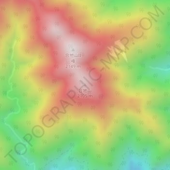
Name: 合地山 topographic map, elevation, terrain.
Location: 合地山, 川根本町, 榛原郡, 静岡県, 日本 (35.27923 138.04496 35.27933 138.04506)
Average elevation: 1,617 m
Minimum elevation: 1,060 m
Maximum elevation: 2,128 m
Other topographic maps
Click on a map to view its topography, its elevation and its terrain.