
大井川ダム topographic map
Interactive map
Click on the map to display elevation.
About this map
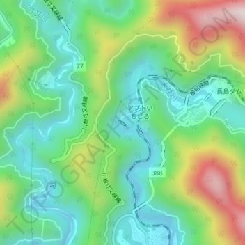
Name: 大井川ダム topographic map, elevation, terrain.
Location: 大井川ダム, 川根本町, 榛原郡, 静岡県, 日本 (35.16439 138.14195 35.16495 138.14289)
Average elevation: 566 m
Minimum elevation: 364 m
Maximum elevation: 980 m
Other topographic maps
Click on a map to view its topography, its elevation and its terrain.