
中ノ尾根山 topographic map
Interactive map
Click on the map to display elevation.
About this map
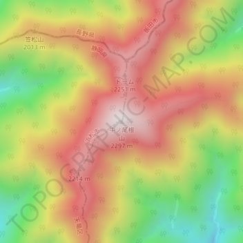
Name: 中ノ尾根山 topographic map, elevation, terrain.
Location: 中ノ尾根山, 川根本町, 榛原郡, 静岡県, 日本 (35.29417 138.01805 35.29427 138.01815)
Average elevation: 1,921 m
Minimum elevation: 1,464 m
Maximum elevation: 2,292 m
中ノ尾根山(なかのおねやま)は、静岡県浜松市天竜区と川根本町の境に位置する標高2296.4mの山であり、浜松市の最高峰である。いわゆる南アルプスの深南部に位置する。
Other topographic maps
Click on a map to view its topography, its elevation and its terrain.