
大無間山 topographic map
Interactive map
Click on the map to display elevation.
About this map
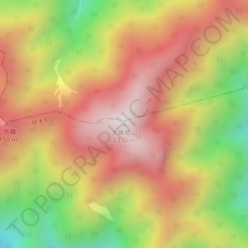
Name: 大無間山 topographic map, elevation, terrain.
Location: 大無間山, 川根本町, 榛原郡, 静岡県, 日本 (35.25595 138.16150 35.25605 138.16160)
Average elevation: 1,872 m
Minimum elevation: 1,301 m
Maximum elevation: 2,310 m
大無間山(だいむげんざん)は、静岡県の赤石山脈の深南部にある標高2,330 mの山。日本二百名山に選定されている。
Other topographic maps
Click on a map to view its topography, its elevation and its terrain.