
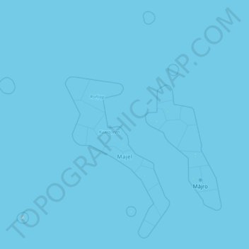
Marshall Islands topographic map
Interactive map
Click on the map to display elevation.
About this map
Name: Marshall Islands topographic map, elevation, terrain.
Location: Marshall Islands (4.36970 160.59113 14.92407 172.37401)
Average elevation: 0 m
Minimum elevation: 0 m
Maximum elevation: 206 m
The average altitude above sea level for the entire country is 7 feet (2.1 m).
Other topographic maps
Click on a map to view its topography, its elevation and its terrain.
Hyderabad
India > Telangana > Bahadurpura mandal
Hyderabad, Bahadurpura mandal, Hyderabad District, Telangana, India
Average elevation: 549 m
India
India
Average elevation: 1,017 m
Haywood County
United States > North Carolina
Haywood County, North Carolina, United States
Average elevation: 1,044 m
Krishnagiri District
Krishnagiri District, Tamil Nadu, India
Average elevation: 653 m
Sri Lanka
Sri Lanka
Average elevation: 50 m
Montreal
Canada > Quebec > Urban agglomeration of Montreal > Montreal
Montreal, Urban agglomeration of Montreal, Montreal (06), Quebec, H3B 1M7, Canada
Average elevation: 30 m
Bengaluru
India > Karnataka > Bangalore North
Bengaluru, Bangalore North, Bengaluru Urban District, Karnataka, India
Average elevation: 881 m
Snohomish County
Snohomish County, Washington, United States
Average elevation: 649 m
Mangerton
Australia > New South Wales > Wollongong City Council
Mangerton, Wollongong City Council, New South Wales, 2500, Australia
Average elevation: 31 m
Sujanpur
India > Punjab > Pathankot Tahsil
Sujanpur, Pathankot Tahsil, Pathankot District, Punjab, 145023, India
Average elevation: 334 m
Kannamedi
India > Karnataka > Pavagada taluk
Kannamedi, Pavagada taluk, Tumakuru District, Karnataka, India
Average elevation: 708 m
Pedda Arikatla
India > Andhra Pradesh > Konakanamitla
Pedda Arikatla, Konakanamitla, Prakasam, Andhra Pradesh, 523245, India
Average elevation: 119 m
Ocheretyne
Ocheretyne, Ocheretyne settlement hromada, Pokrovskii Raion, Donetsk Oblast, 86020, Ukraine
Average elevation: 227 m
Tacoma
United States > Washington > Pierce County
Tacoma, Pierce County, Washington, United States
Average elevation: 67 m
Ooty Lake
India > Tamil Nadu > Udhagamandalam > Udhagamandalam
Ooty Lake, Udhagamandalam, The Nilgiris District, Tamil Nadu, 643001, India
Average elevation: 2,235 m
Hinton
United States > Iowa > Plymouth County
Hinton, Plymouth County, Iowa, 51204, United States
Average elevation: 362 m
Kandy
Kandy, Kandy District, Central Province, 20000, Sri Lanka
Average elevation: 621 m
Thiruvananthapuram
India > Kerala > Thiruvananthapuram
Thiruvananthapuram, Thiruvananthapuram District, Kerala, 695001, India
Average elevation: 33 m
Nepal
Nepal
Average elevation: 2,604 m
Lake Tahoe
United States > California > Placer County
Lake Tahoe, Placer County, California, United States
Average elevation: 2,077 m
Sion Fort
India > Maharashtra > Mumbai
Sion Fort, Road No 1, Sion Koliwada, F/N Ward, Zone 2, Mumbai, Maharashtra, 400022, India
Average elevation: 6 m
Kharki
India > Madhya Pradesh > Pandhana Tahsil
Kharki, Pandhana Tahsil, Khandwa District, Madhya Pradesh, India
Average elevation: 317 m
Hariharapura
India > Karnataka > Koppa taluk
Hariharapura, Koppa taluk, Chikkamagaluru District, Karnataka, 577120, India
Average elevation: 648 m
Pullalarevu
India > Andhra Pradesh > Raptadu
Pullalarevu, Raptadu, Anantapur, Andhra Pradesh, 515722, India
Average elevation: 389 m
Musti
India > Maharashtra > Solapur South
Musti, Solapur South, Solapur District, Maharashtra, 413573, India
Average elevation: 487 m
Mambakkam
India > Tamil Nadu > Tiruporur
Mambakkam, Tiruporur, Chengalpattu District, Tamil Nadu, 600127, India
Average elevation: 16 m
Tigawan
India > Madhya Pradesh > Panna Tahsil > Tilguwan
Tigawan, Tilguwan, Panna Tahsil, Panna District, Madhya Pradesh, India
Average elevation: 407 m
A`zaz
A`zaz, Azaz Subdistrict, Azaz District, Aleppo Governorate, Syria
Average elevation: 559 m
Winterborne Kingston
United Kingdom > England > Dorset
Winterborne Kingston, Dorset, England, United Kingdom
Average elevation: 77 m