
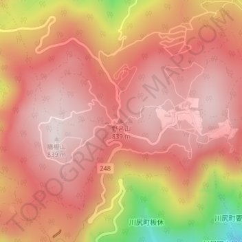
野呂山 topographic map
Interactive map
Click on the map to display elevation.
About this map
Name: 野呂山 topographic map, elevation, terrain.
Location: 野呂山, 呉市, 広島県, 日本 (34.26424 132.67486 34.26434 132.67496)
Average elevation: 675 m
Minimum elevation: 267 m
Maximum elevation: 836 m
野呂山(のろさん)は、広島県呉市に位置する標高839mの山で、膳棚山と弘法寺山を結ぶ東西2kmの高原の総称である。瀬戸内海国立公園の区域に指定されている。
Other topographic maps
Click on a map to view its topography, its elevation and its terrain.