
駒津峰 topographic map
Interactive map
Click on the map to display elevation.
About this map
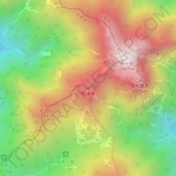
Name: 駒津峰 topographic map, elevation, terrain.
Location: 駒津峰, 伊那市, 長野県, 日本 (35.75322 138.22941 35.75332 138.22951)
Average elevation: 2,328 m
Minimum elevation: 1,720 m
Maximum elevation: 2,939 m
Other topographic maps
Click on a map to view its topography, its elevation and its terrain.