
津久井湖 topographic map
Interactive map
Click on the map to display elevation.
About this map
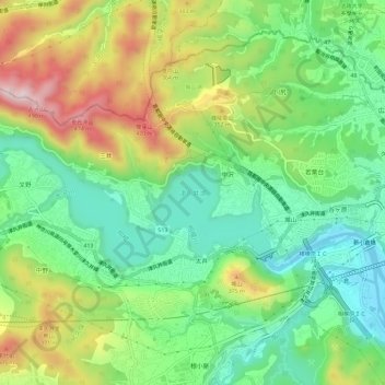
Name: 津久井湖 topographic map, elevation, terrain.
Location: 津久井湖, 相模原市, 神奈川県, 日本 (35.58408 139.22602 35.60265 139.28431)
Average elevation: 222 m
Minimum elevation: 66 m
Maximum elevation: 482 m
Other topographic maps
Click on a map to view its topography, its elevation and its terrain.