
相模ダム topographic map
Interactive map
Click on the map to display elevation.
About this map
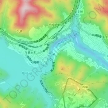
Name: 相模ダム topographic map, elevation, terrain.
Location: 相模ダム, 緑区, 相模原市, 神奈川県, 日本 (35.61501 139.19460 35.61568 139.19634)
Average elevation: 255 m
Minimum elevation: 127 m
Maximum elevation: 528 m
Other topographic maps
Click on a map to view its topography, its elevation and its terrain.