
南区 topographic map
Interactive map
Click on the map to display elevation.
About this map
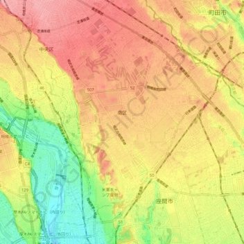
Name: 南区 topographic map, elevation, terrain.
Location: 南区, 相模原市, 神奈川県, 日本 (35.49030 139.35522 35.56212 139.45848)
Average elevation: 85 m
Minimum elevation: 21 m
Maximum elevation: 133 m
Other topographic maps
Click on a map to view its topography, its elevation and its terrain.