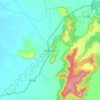
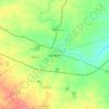
Pench topographic map
Click on the map to display elevation.
Pench
The river separates Pench National Park into two halves, east and west Pench. The Pench Tiger Reserve derives its name after the Pench River, which flows from north to south across the reserve. The reserve is situated on the south of the Satpura Hill Ranges in the Seoni District and Chhindwara District in the Madhya Pradesh state of India. The topography is undulating, with most of the area enclosed by small hill ranges and abrupt slopes on all the sides. The Pench river flowing through the centre of the Reserve is usually dry by April, but a number of water pools, locally known as dohs, are found along the course of the river. These serve as waterholes for wild animals. A few perennial springs also exist in the region. Recently, a number of earthen ponds and shallow wells have been created, providing well-distributed sources of water across the reserve.
About this map

Name: Pench topographic map, elevation, terrain.
Location: Pench, Madhya Pradesh, India (21.26866 78.78988 22.24280 79.34844)
Average elevation: 495 m
Minimum elevation: 253 m
Maximum elevation: 902 m
Other topographic maps
Click on a map to view its topography, its elevation and its terrain.
Indore
India > Madhya Pradesh > Juni Indore Tahsil
Indore /ɪnˈdɔːr/ (listen) is the most populous and the largest city in the Indian state of Madhya Pradesh. It serves as the headquarters of both Indore District and Indore Division. It is also considered as an education hub of the state and has campuses of both the Indian Institute of Technology and the…
Average elevation: 555 m




Ujjain
India > Madhya Pradesh > Ujjain NagarTahsil
Ujjain is located in the west-central part of India, and is north of the upper limit of the Vindhya mountain ranges. Located on the Malwa plateau, it is higher than the north Indian plains and the land rises towards the Vindhya Range to the south. Ujjain's co-ordinates are 23°10′N 75°46′E /…
Average elevation: 501 m
Bhopal
India > Madhya Pradesh > Huzur Tahsil
Bhopal has an average elevation of 500 metres (1401 ft) and is located in the central part of India, just north of the upper limit of the Vindhya mountain ranges. Located on the Malwa plateau, it is higher than the north Indian plains and the land rises towards the Vindhya Range to the south. The city has…
Average elevation: 498 m
Vindhya Range
India > Madhya Pradesh > Goharganj Tahsil
Technically, the Vindhyas do not form a single mountain range in the geological sense. The exact extent of the Vindhyas is loosely defined, and historically, the term covered a number of distinct hill systems in central India, including the one that is now known as the Satpura Range. Today, the term…
Average elevation: 504 m
Chanderi
India > Madhya Pradesh > Chanderi Tahsil
Chanderi is located at 24°43′N 78°08′E / 24.72°N 78.13°E / 24.72; 78.13. It has an average elevation of 456 metres (1496 feet).
Average elevation: 440 m



Jhabua
India > Madhya Pradesh > Jhabua Tahsil
Jhabua has an average elevation of 318 metres (1043 feet). Jhabua is located at the bottom left side of MP, mainly towards Gujarat.
Average elevation: 337 m
Bhopal
India > Madhya Pradesh > Huzur Tahsil
Bhopal has an average elevation of 500 metres (1401 ft) and is located in the central part of India, just north of the upper limit of the Vindhya mountain ranges. Located on the Malwa plateau, it is higher than the north Indian plains and the land rises towards the Vindhya Range to the south. The city has…
Average elevation: 498 m
Sagar
India > Madhya Pradesh > Sagar Nagar Tahsil
Sagar has an average elevation of 427 metres (1401 ft) and is located in the central part of India, just north of the upper limit of the Vindhya mountain ranges.here is a lake in middle of the city.
Average elevation: 515 m

Umaria
India > Madhya Pradesh > Bandhogarh Umaria Tahsil
Umaria is located at 23°25′N 78°38′E / 23.42°N 78.63°E / 23.42; 78.63 and has an average elevation of 538 metres (1,765 feet).
Average elevation: 455 m

Damoh
India > Madhya Pradesh > Danyantinagar Tahsil
Damoh is located at 23°53′N 79°27′E / 23.88°N 79.45°E / 23.88; 79.45. It is at an average elevation of 595 metres (1,952 ft).
Average elevation: 362 m





Jabalpur
India > Madhya Pradesh > Jabalpur Tahsil > Jabalpur
The Narmada river bringing in freshwater from the Vindyachal Ranges has developed Jabalpur district into an agrarian economy. The land of the Narmada basin with its fertile alluvial soil gives good yields of sorghum, wheat, rice, and millet in the villages around Jabalpur. Important among commercial crops are…
Average elevation: 413 m



Rampur Baghelan
India > Madhya Pradesh > Rampur Baghelan Tahsil > Rampur Baghelan
Average elevation: 316 m


Jatara
India > Madhya Pradesh > Jatara Tahsil > Jatara
Jatara is located at 25°01′N 79°03′E / 25.02°N 79.05°E / 25.02; 79.05. It has an average elevation of 246 metres (807 feet).it is situated near Khajuraho and Orchha.
Average elevation: 260 m