
Ullensvang topographic map
Interactive map
Click on the map to display elevation.
About this map
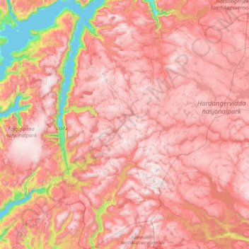
Name: Ullensvang topographic map, elevation, terrain.
Location: Ullensvang, Vestland, Norway (59.69381 6.02662 60.45917 7.48826)
Average elevation: 1,049 m
Minimum elevation: 0 m
Maximum elevation: 1,709 m
Other topographic maps
Click on a map to view its topography, its elevation and its terrain.