
Thank you for supporting this site ❤️
Make a donation
Make a donation
Bergen topographic map
Click on the map to display elevation.
Thank you for supporting this site ❤️
Make a donation
Make a donation
About this map
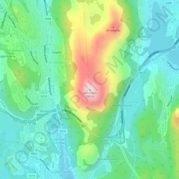
Name: Bergen topographic map, elevation, terrain.
Location: Bergen, Vestland, 5171, Norway, Lyderhorn (60.37374 5.24204 60.37384 5.24214)
Average elevation: 111 m
Minimum elevation: 1 m
Maximum elevation: 388 m
Thank you for supporting this site ❤️
Make a donation
Make a donation
Other topographic maps
Click on a map to view its topography, its elevation and its terrain.