
Thank you for supporting this site ❤️
Make a donation
Make a donation
Haukland topographic map
Click on the map to display elevation.
Thank you for supporting this site ❤️
Make a donation
Make a donation
About this map
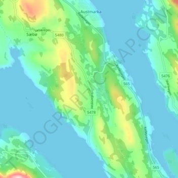
Name: Haukland topographic map, elevation, terrain.
Location: Haukland, Alver, Vestland, 5938, Norway (60.58140 5.15964 60.62140 5.19964)
Average elevation: 47 m
Minimum elevation: -2 m
Maximum elevation: 248 m
Thank you for supporting this site ❤️
Make a donation
Make a donation
Other topographic maps
Click on a map to view its topography, its elevation and its terrain.