
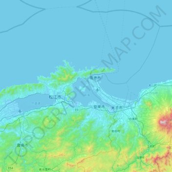
松島 topographic map
Interactive map
Click on the map to display elevation.
About this map
Name: 松島 topographic map, elevation, terrain.
Location: 松島, 松江市, 島根県, 690-1404, 日本 (35.18610 132.87151 35.82610 133.51151)
Average elevation: 125 m
Minimum elevation: -5 m
Maximum elevation: 1,698 m
Other topographic maps
Click on a map to view its topography, its elevation and its terrain.