
白髪山 topographic map
Interactive map
Click on the map to display elevation.
About this map
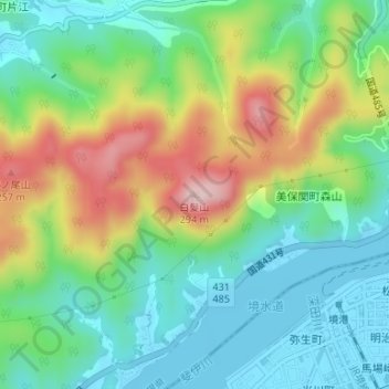
Name: 白髪山 topographic map, elevation, terrain.
Location: 白髪山, 松江市, 島根県, 6840004, 日本 (35.55276 133.21032 35.55286 133.21042)
Average elevation: 93 m
Minimum elevation: -1 m
Maximum elevation: 270 m
Other topographic maps
Click on a map to view its topography, its elevation and its terrain.