
大黒島 topographic map
Interactive map
Click on the map to display elevation.
About this map
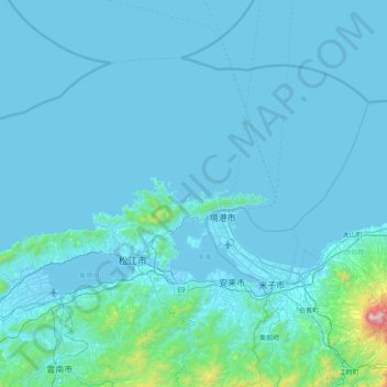
Name: 大黒島 topographic map, elevation, terrain.
Location: 大黒島, 松江市, 島根県, 6901313, 日本 (35.25600 132.85307 35.89600 133.49307)
Average elevation: 69 m
Minimum elevation: -5 m
Maximum elevation: 1,698 m
Other topographic maps
Click on a map to view its topography, its elevation and its terrain.