
Catazajá topographic map
Interactive map
Click on the map to display elevation.
About this map
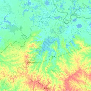
Name: Catazajá topographic map, elevation, terrain.
Location: Catazajá, Chiapas, Mexico (17.59280 -92.18636 17.94334 -91.77953)
Average elevation: 20 m
Minimum elevation: -7 m
Maximum elevation: 73 m
Other topographic maps
Click on a map to view its topography, its elevation and its terrain.