
La Libertad topographic map
Interactive map
Click on the map to display elevation.
About this map
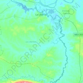
Name: La Libertad topographic map, elevation, terrain.
Location: La Libertad, Chiapas, Mexico (17.46945 -91.87164 17.73179 -91.63429)
Average elevation: 34 m
Minimum elevation: -2 m
Maximum elevation: 275 m
Other topographic maps
Click on a map to view its topography, its elevation and its terrain.