
Yajalón topographic map
Interactive map
Click on the map to display elevation.
About this map
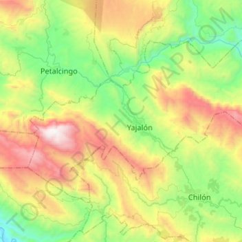
Name: Yajalón topographic map, elevation, terrain.
Location: Yajalón, Chiapas, Mexico (17.09992 -92.44536 17.25530 -92.20347)
Average elevation: 1,154 m
Minimum elevation: 392 m
Maximum elevation: 2,465 m
Other topographic maps
Click on a map to view its topography, its elevation and its terrain.