
Thank you for supporting this site ❤️
Make a donation
Make a donation
Enterprise topographic map
Click on the map to display elevation.
Thank you for supporting this site ❤️
Make a donation
Make a donation
About this map
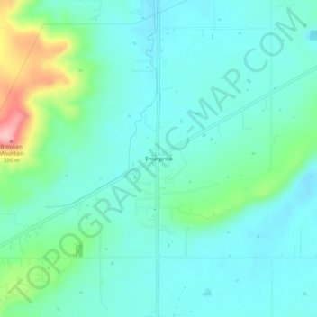
Name: Enterprise topographic map, elevation, terrain.
Location: Enterprise, Haskell County, Oklahoma, United States (35.20982 -95.39997 35.24982 -95.35997)
Average elevation: 214 m
Minimum elevation: 181 m
Maximum elevation: 338 m
Thank you for supporting this site ❤️
Make a donation
Make a donation
Other topographic maps
Click on a map to view its topography, its elevation and its terrain.