
Thank you for supporting this site ❤️
Make a donation
Make a donation
Whitefield topographic map
Click on the map to display elevation.
Thank you for supporting this site ❤️
Make a donation
Make a donation
About this map
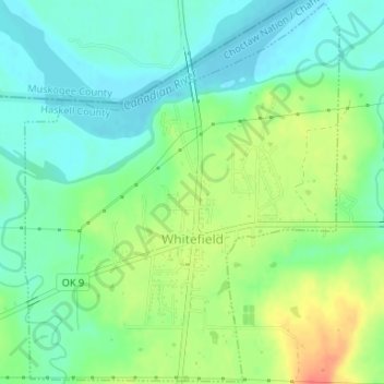
Name: Whitefield topographic map, elevation, terrain.
Location: Whitefield, Haskell County, Oklahoma, 74472, United States (35.24255 -95.25191 35.26920 -95.22483)
Average elevation: 162 m
Minimum elevation: 143 m
Maximum elevation: 194 m
Thank you for supporting this site ❤️
Make a donation
Make a donation
Other topographic maps
Click on a map to view its topography, its elevation and its terrain.