
Thank you for supporting this site ❤️
Make a donation
Make a donation
Keota topographic map
Click on the map to display elevation.
Thank you for supporting this site ❤️
Make a donation
Make a donation
About this map
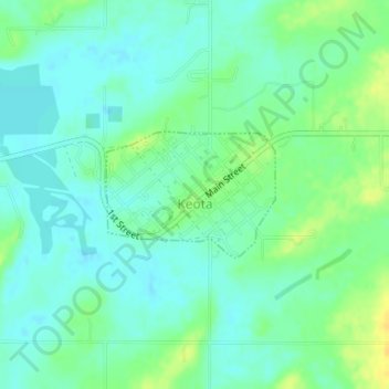
Name: Keota topographic map, elevation, terrain.
Location: Keota, Haskell County, Oklahoma, United States (35.25191 -94.92918 35.26068 -94.91480)
Average elevation: 149 m
Minimum elevation: 140 m
Maximum elevation: 164 m
Thank you for supporting this site ❤️
Make a donation
Make a donation
Other topographic maps
Click on a map to view its topography, its elevation and its terrain.