
下倉田町 topographic map
Interactive map
Click on the map to display elevation.
About this map
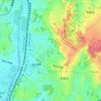
Name: 下倉田町 topographic map, elevation, terrain.
Location: 下倉田町, 戸塚区, 横浜市, 神奈川県, 231-0017, 日本 (35.37761 139.53225 35.38925 139.55168)
Average elevation: 38 m
Minimum elevation: 7 m
Maximum elevation: 91 m
Other topographic maps
Click on a map to view its topography, its elevation and its terrain.