
小山台 topographic map
Interactive map
Click on the map to display elevation.
About this map
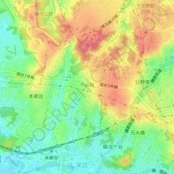
Name: 小山台 topographic map, elevation, terrain.
Location: 小山台, 栄区, 横浜市, 神奈川県, 247-0002, 日本 (35.37326 139.55409 35.38147 139.56069)
Average elevation: 50 m
Minimum elevation: 12 m
Maximum elevation: 91 m
Other topographic maps
Click on a map to view its topography, its elevation and its terrain.