
Sers topographic map
Interactive map
Click on the map to display elevation.
About this map
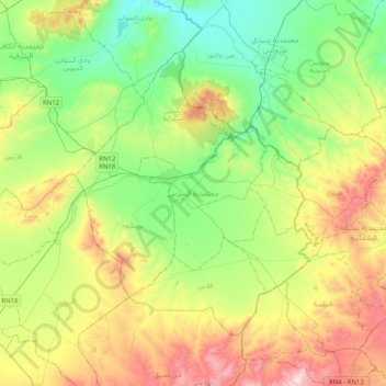
Name: Sers topographic map, elevation, terrain.
Location: Sers, Le Kef, Tunisie (35.94308 8.76687 36.18301 9.17076)
Average elevation: 601 m
Minimum elevation: 331 m
Maximum elevation: 1,111 m
Other topographic maps
Click on a map to view its topography, its elevation and its terrain.