
Sakiet Sidi Youssef topographic map
Interactive map
Click on the map to display elevation.
About this map
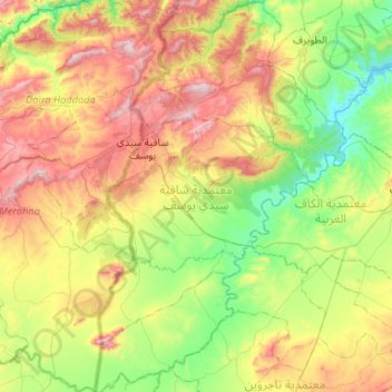
Name: Sakiet Sidi Youssef topographic map, elevation, terrain.
Location: Sakiet Sidi Youssef, Le Kef, Tunisie (35.95630 8.29082 36.38170 8.62837)
Average elevation: 571 m
Minimum elevation: 258 m
Maximum elevation: 1,117 m
Other topographic maps
Click on a map to view its topography, its elevation and its terrain.