
Faisalabad City Tehsil topographic map
Interactive map
Click on the map to display elevation.
Faisalabad City Tehsil
The soil consists of young stratified silt loam or very fine sand loam which makes the subsoil weak in structure with common kankers at only five feet. The course of the rivers within Faisalabad is winding and often subject to frequent alternations. In the rainy season, the currents are very strong. This leads to high floods in certain areas which do last for a number of days. The Rakh and Gogera canals have encouraged the water levels in the district however the belt on the Ravi River has remained narrow. The river bed does include the river channels which have shifted the sand bars and low sandy levees leading to river erosion. Faisalabad is situated at the centre of the lower Rechna Doab, the area is located between the Chenab and Ravi rivers. There is a mild slope from the northeast to the southwest with an average fall of 0.2–0.3 metres per kilometre (1.1–1.6 feet per mile). The city is situated at an elevation of about 183 metres (600 ft). The topography is marked by valleys, local depression and high ground.
About this map
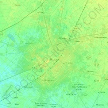
Name: Faisalabad City Tehsil topographic map, elevation, terrain.
Location: Faisalabad City Tehsil, Faisalabad District, Punjab, Pakistan (31.33564 72.99379 31.52644 73.19304)
Average elevation: 185 m
Minimum elevation: 178 m
Maximum elevation: 191 m
Other topographic maps
Click on a map to view its topography, its elevation and its terrain.
Murree
Pakistan > Punjab > Murree District
Murree (Punjabi, Urdu: مری) is a mountain resort city, located in the Galyat region of the Pir Panjal Range, within the Murree District of Punjab, Pakistan. It forms the outskirts of the Islamabad-Rawalpindi metropolitan area, and is about 30 km (19 mi) northeast of Islamabad. It has average altitude of…
Average elevation: 1,718 m
Ravi River
Pakistan > Punjab > Yahya Nagar
The Ravi River originates in the Himalayas in the Multhan tehsil of Kangra district of Himachal Pradesh, India. It follows a north-westerly course and is a perennial river. It is the smallest of the five Punjab rivers that rise from glacier fields at an elevation of 14,000 feet (4,300 m), on the southern side…
Average elevation: 215 m
Rawalpindi
Pakistan > Punjab > Rawalpindi District > Rawalpindi Cantonment
Rawalpindi features a humid subtropical climate (Köppen: Cwa) with hot and wet summers, a cooler and drier winter. Rawalpindi and its twin city Islamabad, during the year experiences an average of 91 thunderstorms, which is the highest frequency of any plain elevation city in the country. Strong windstorms…
Average elevation: 530 m
Manglia
Manglia (Urdu: منگلیہ ) is a medium village of tehsil Kharian, District Gujrat, in the Punjab province of Pakistan. It is located at 32°86'N 73°97'E with an altitude of 271.5 metres). Manglia has many castes including Syed, Jutt, Awan, Malik, Mughal, and Kasbi. 32°52′N 73°59′E / 32.867°N…
Average elevation: 300 m