
Thank you for supporting this site ❤️
Make a donation
Make a donation
Thatti topographic map
Click on the map to display elevation.
Thank you for supporting this site ❤️
Make a donation
Make a donation
About this map
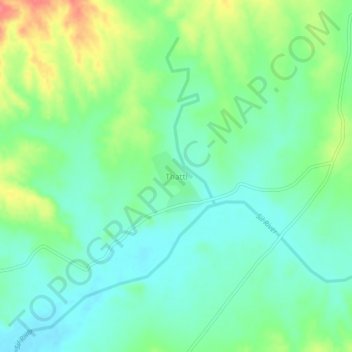
Name: Thatti topographic map, elevation, terrain.
Location: Thatti, District Attock, Punjab, Pakistan (33.18118 72.11074 33.22118 72.15074)
Average elevation: 303 m
Minimum elevation: 281 m
Maximum elevation: 347 m
Thank you for supporting this site ❤️
Make a donation
Make a donation