
Thank you for supporting this site ❤️
Make a donation
Make a donation
Greenbrier County topographic map
Click on the map to display elevation.
Thank you for supporting this site ❤️
Make a donation
Make a donation
About this map
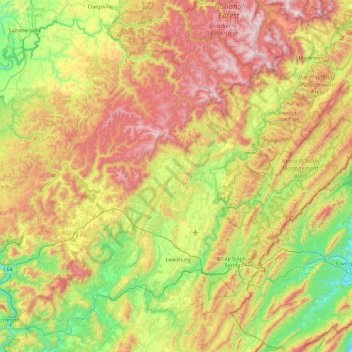
Name: Greenbrier County topographic map, elevation, terrain.
Location: Greenbrier County, West Virginia, United States (37.68386 -80.89420 38.26733 -79.95984)
Average elevation: 785 m
Minimum elevation: 364 m
Maximum elevation: 1,420 m
Thank you for supporting this site ❤️
Make a donation
Make a donation
Other topographic maps
Click on a map to view its topography, its elevation and its terrain.
Thank you for supporting this site ❤️
Make a donation
Make a donation
Thank you for supporting this site ❤️
Make a donation
Make a donation