
Thank you for supporting this site ❤️
Make a donation
Make a donation
Summers County topographic map
Click on the map to display elevation.
Thank you for supporting this site ❤️
Make a donation
Make a donation
About this map
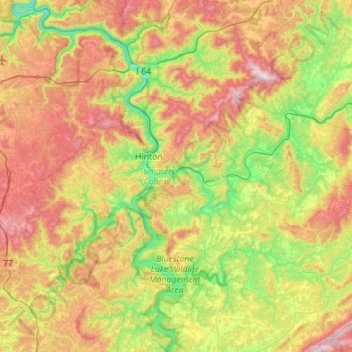
Name: Summers County topographic map, elevation, terrain.
Location: Summers County, West Virginia, United States (37.42957 -81.09421 37.86896 -80.66033)
Average elevation: 685 m
Minimum elevation: 342 m
Maximum elevation: 1,192 m
Thank you for supporting this site ❤️
Make a donation
Make a donation
Other topographic maps
Click on a map to view its topography, its elevation and its terrain.
Thank you for supporting this site ❤️
Make a donation
Make a donation
Thank you for supporting this site ❤️
Make a donation
Make a donation