
Menzel Chaker topographic map
Interactive map
Click on the map to display elevation.
About this map
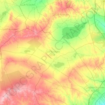
Name: Menzel Chaker topographic map, elevation, terrain.
Location: Menzel Chaker, Sfax, Tunisie (34.81633 10.05344 35.24197 10.71146)
Average elevation: 129 m
Minimum elevation: 25 m
Maximum elevation: 267 m
Other topographic maps
Click on a map to view its topography, its elevation and its terrain.